This project is part of an effort to compile a digital map and historical geography of Texas and Northeastern Mexico from contemporary sources who kept travel diaries of their expeditions in the area. Eventually encompassing the period from 1686 - 1768, this first phase of the project focuses on the year 1767, and will be part of the TraveLog platform under development by the Rice University Humanities Research Center.
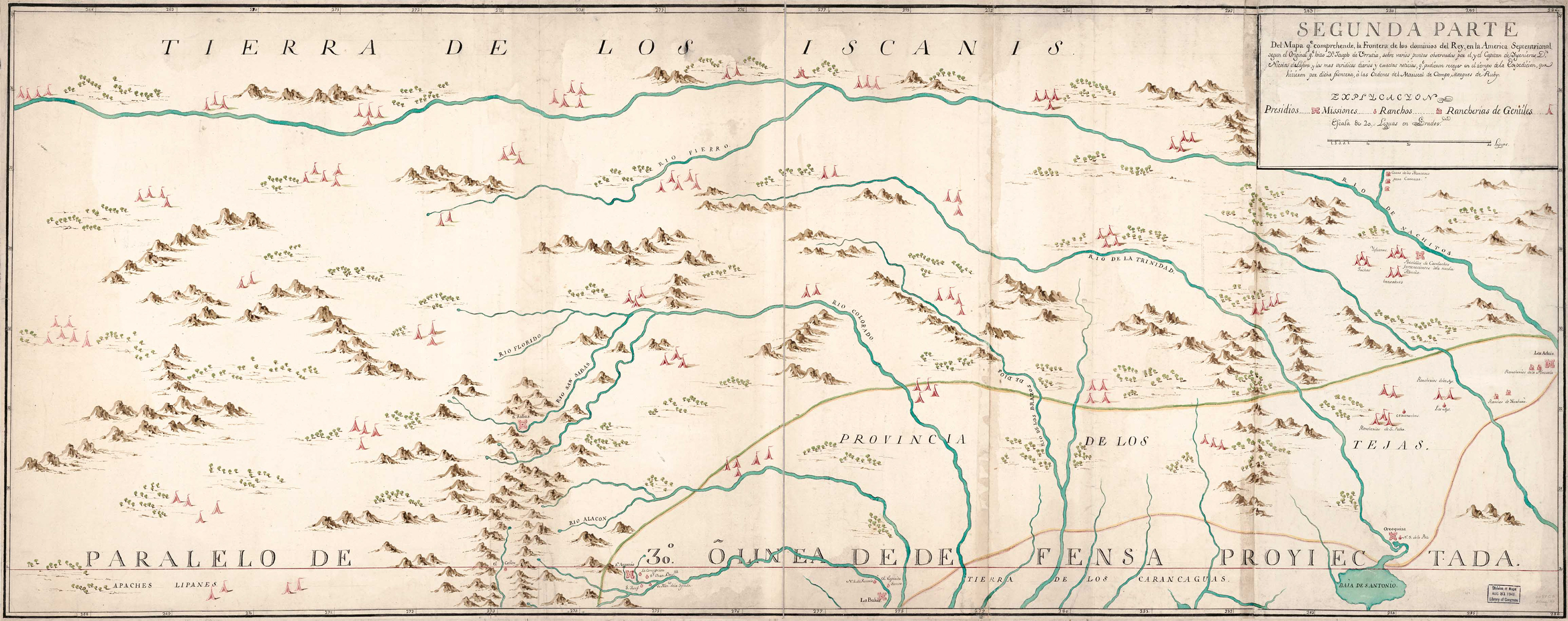
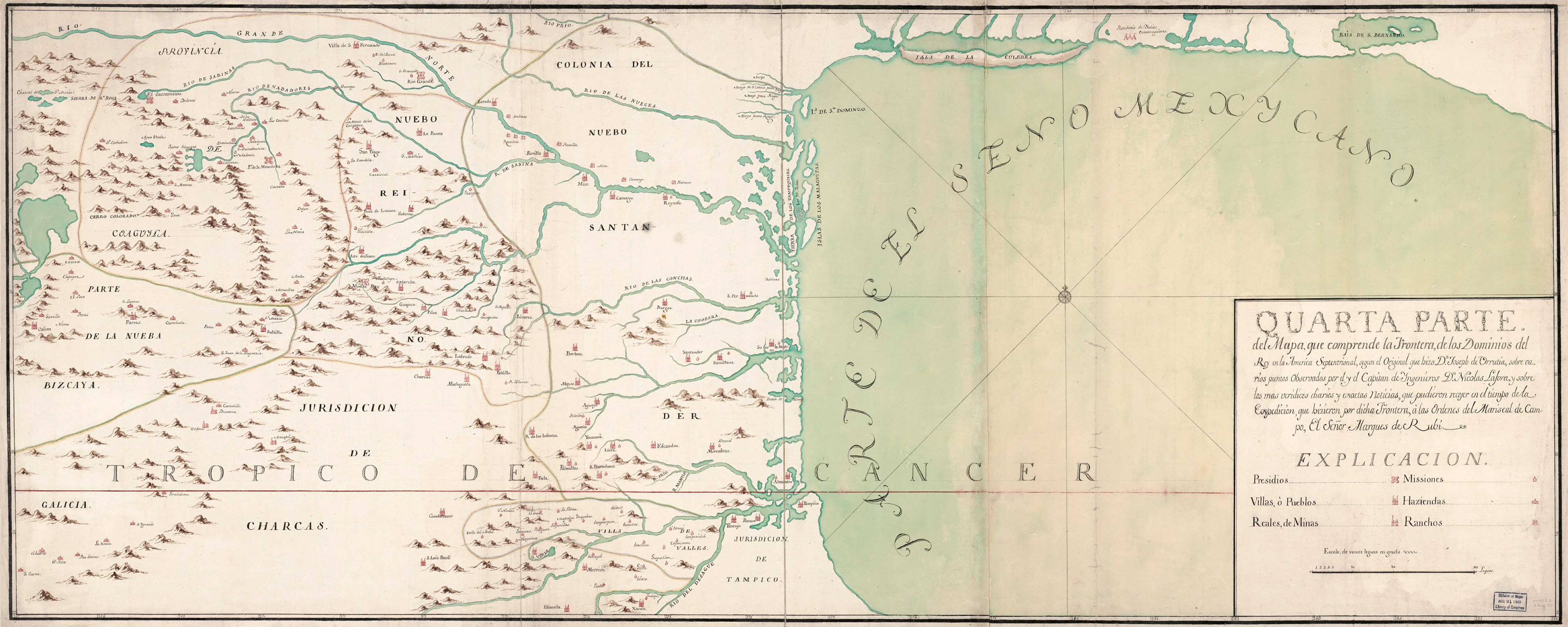
José de Urrutia and Nicolas de Lafora (1769). Mapa, que comprende la Frontera, de los Dominios del Rey, en la America Septentrional. Library of Congress.
1767 was an important year in the formation of early Texas, one that saw a shift away from the mission-presidio pattern of occupation, towards the growth of settlements comprised of land-owning civilians. Between June and November 1767, the Marques de Rubí, on orders of King Carlos III, traveled through the province of Texas to inspect the military installations. Disappointed by what he found, Rubí recommended the complete withdrawal of Spanish presence from east Texas, and the reinforcement of a “realistic” frontier that ran from Mission San Juan Bautista (approx. 35 miles downriver from Eagle Pass), to Matagorda Bay. The summer of 1767 also saw the “General Visit” of the Royal Commissioners, whose purpose was to adjudicate land grants to the settlers in the five Villas del Norte established by José de Escandón in the Lower Rio Grande Valley between 1749-1755 (Laredo, Revilla, Mier, Camargo, and Reynosa). Though part of the province of Nuevo Santander at the time, and not part of Texas until 1845, the ranches established by these settlers north of the Rio Grande not only influenced the vernacular architecture and pattern of land tenure in the region, they also brought with them the ranching culture whose influence is felt in Texas to the present day. This project traces the simultaneous unfolding of these two “visits” - by the Marques de Rubí, and the Royal Commissioners - through their own words, demonstrating how they perceived and shaped distinct Tejano populations. The project is also interested in the engineers and surveyors, instrumental on both expeditions, who were responsible for measuring, documenting, and mapping the land and settlements they encountered.